Mueller Park is a classic “must do” trail located in Bountiful, Utah. This trail is mostly on the north facing slope in Mueller Canyon and can either be done as an out-n-back to Rudy’s flat or a loop in conjunction with North Canyon. The trail is very smooth with some mostly small rocks along the trail. There are some narrow bridges and one that has a pretty good dogleg in the middle.
From Rudy’s flat you are presented with a fantastic view into Salt Lake looking down city Creek Canyon. From Rudy’s Flat you can either turn around and go back the way you came or continue on into North Canyon and then follow Bountiful Boulevard North back to 1800 south and then a short uphill back to your car at the trailhead.
Mueller Park is typically a good late spring to mid-fall ride due to the North facing nature. On big snow years it is possible to encounter the white stuff into June in some places.
A popular option is to ride from the trailhead to “Elephant Rock” (sometimes referred to as “white rock”) and back for a 7-mile out-n-back quickie in the afternoon.
Trail Map
Coming soon
Additional Trail Notes, Obstacles etc
This is a very popular trail so be sure to ride aware, especially when riding downhill. In addition to other cyclists, you will likely encounter hikers and may even encounter Deer, Moose and other wildlife.
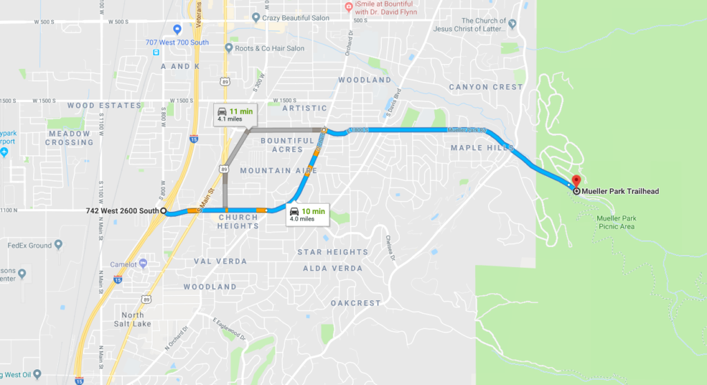
Directions to Trailhead
- From I-15 take the 2600 South Woods Cross Exit (Exit #315).
- Travel East on 2600 South.
- Continue following the road as it turns North and becomes Orchard Drive
- Turn East on 1800 South
- Drive up the long hill past the summit and down into the canyon.
- The trailhead is on the right just after you enter the canyon.


